Please scroll down to follow our journey to Arctic Sweden and Norway lasting from 22nd April to 30th June 2014

Spring is here and we're planning to set off this Tuesday 22nd April.

Hopefully we'll be able to pick up wifi and add to this blog as we travel around as we've now got a new aerial which can be fixed on the side of our campervan with suction cups and can connect to wifi sources from some considerable distance.

It's always hard to leave Widecombe but the weather isn't too good today Monday 21st April so the prospect is easier.. The flowers on our cherry tree are out but we're going to miss lots of nice things blooming in the garden while we're away.

We're busy packing things into the van in anticipation of setting off tomorrow.

It's always a bit worrying that you might have forgotten something really essential when you're preparing for a long trip.

On Tuesday 22nd April we left home about mid day. Later on we visited the new Stonehenge Visitor Centre - very impressive.

Inside the visitor centre exhibition was this amazing ever changing circular projection of the stones as if you were standing in the centre of the monument - sensational! We could have visited the stones for free on one of the shuttle buses which run from the visitor centre as Roger is a National Trust member and English Heritage offer reciprocal rights on this site, but we didn't as we have seen the stones many times.

We found a nice car park by the Kennet and Avon Canal near reading for the night. Took a walk down the canal- lots of residential narrow boats and barges moored along the banks. Probably quite a cheap form of housing this close to London!

On Wednesday 23rd April we travelled on to Harwich in Essex and boarded the DFDS Ferry going to Esjberg in Denmark which left at about 17.30.

We had a very nice evening meal on the ferry which was a buffet with lots of fishes - very Scandinavian - it's a Danish ship.

Here's what our cabin looked like - nice sea view.

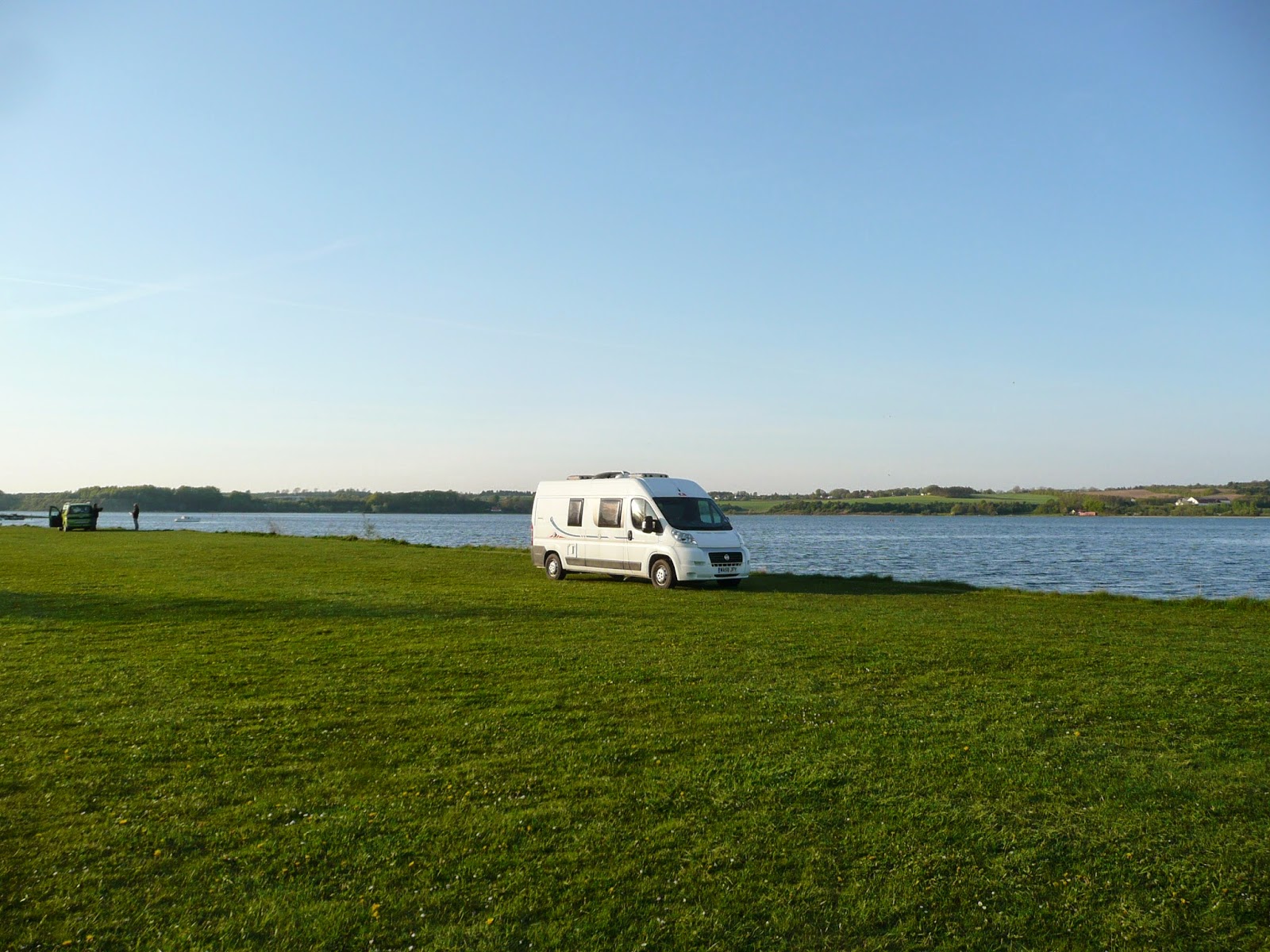
We arrived in Esjberg on the west coast of Jutland at about 13.00 on Thursday 24th April and came north up the coast to the little town of Nymindegab which is situated between the North Sea and an enormous fresh water lake called Ringkobing Fjord. Here'a a view of our parking place right next to a posh hotel with excellent free wifi.

We took a walk over the sand dunes to the beach where there was some impressive second world war archaeology.

We came back and had a walk round town. Lots of quite interesting thatched houses but all apparently empty at this time of year - holiday homes I imagine. We are not too far from the German border here and there are lots of German registration vehicles around. Maybe they own the holiday homes?.

Before leaving Nymindegab on Friday 25th April we had a look around the local dunes and lakes.

Saw these strange fungi growing on old cow? dung.

Also lots of birds around. Are these Eider Ducks?

Later we moved on north to a church by a lake.

Saw lots of wild geese on the wetlands on the edge of the lake by the church. Also saw two Roe? deer but couldn't photograph them as they were skulking in the reeds.

Continued north and visited this beautiful beach on the North Sea coast. There were more relics of Nazi gun emplacements on the beach.

A little further on we found these prehistoric burial mounds. These particular ones have some degree of protection but we saw a lot more which seem to be at risk of being ploughed over.

Eventually we stopped for the night at this beautiful spot in Thy National Park on the north west coast of Jutland.

The next day Saturday 26th April we visited two more sites in Thy National Park. At Stenjberg (above) the fishing people use tractors to launch and recover their boats on the beach.

We also visited Isjberg - the highest point in the National Park at 56 metres! Here's a flowering tree we found on the way up.

There's a great view in all directions from the top. This photo does not do justice
.

We stopped for the night at this very nice layby in wetlands with a bird-spotting tower adjacent. Saw many birds - Geese - Ducks - Marsh Harrier and heard Bittern booming! We went for a really nice walk in nearby woods.

A lovely spot. As it got dark we saw numerous bats. The Bittern went on booming way into the night.

On Sunday 27th April we travelled north west to Tars where there is a good motorhome service point provided by a motorhome dealer where we did clothes washing and filled and a emptied our tanks. We then moved on to a layby (pictured above) between Hirtshals and Albaek for the night.

This morning Sunday 28th April we moved on to Grenen at the very north most tip of Jutland (and Denmark) where the two seas of Skagerack and Kategat meet. The car park was full of German registered vehicles.

I'm not sure how this message (room to let in German) on a second world war Nazi bunker was going down with the German visitors!?

We walked right to the end of the northernmost sand spit where the two seas meet.

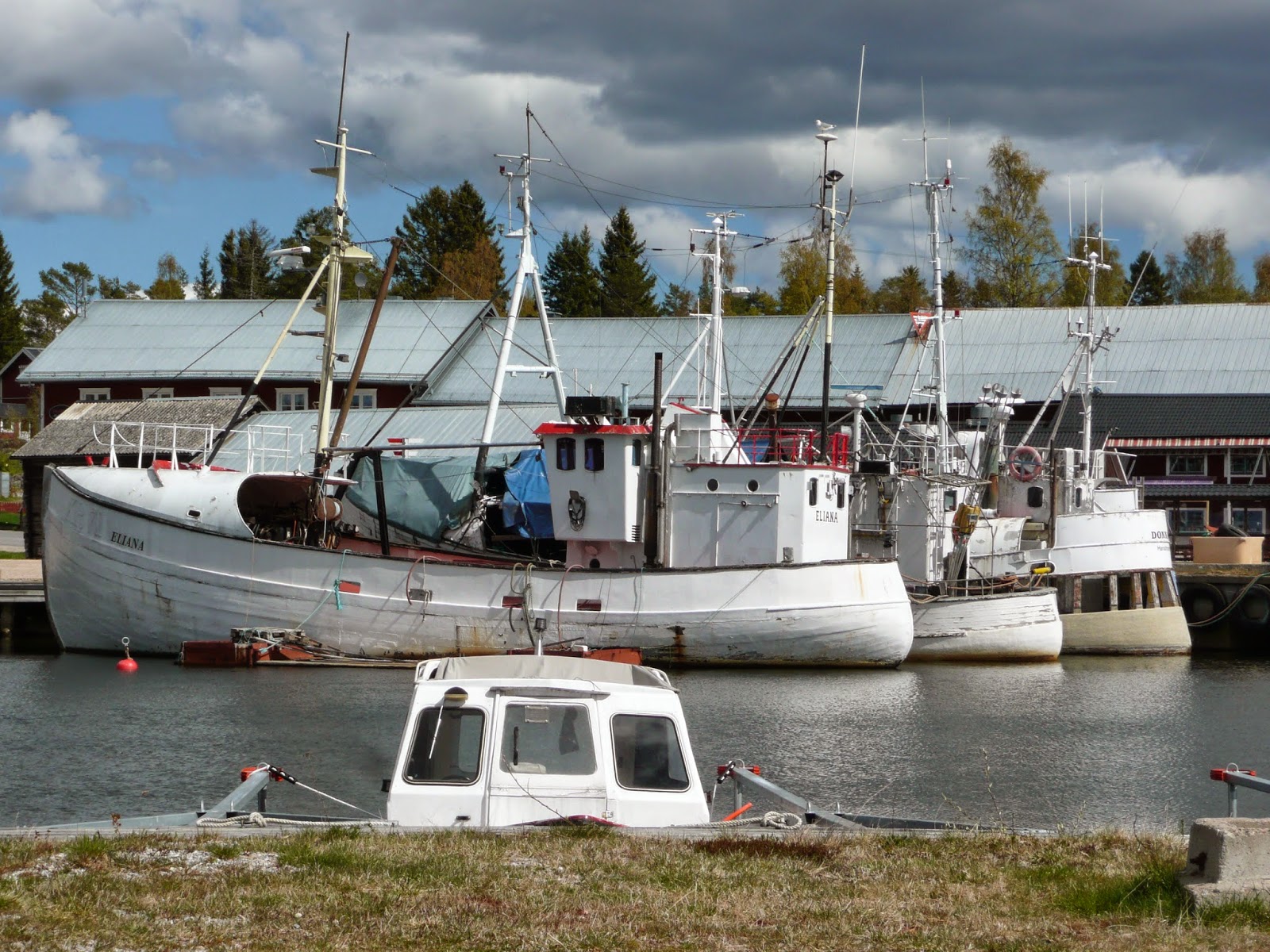
This afternoon we headed south down the east coast of Jutland, through the port of Frederikshavn and on to the village of Voesa where we are parked next to a canal with some nice public art.

A dragon maybe?

It's Tuesday morning 29th April. Actually we've decided we're parked by a river, not a canal, it's flowing.

We were a bit confused by the meaning of this sign across the river.....

Must mean these yellow boat things??

A womens' walking club turned up for a picnic by the river.

Nice spot but we're off now.

We moved on to Linholm Hoje a Viking Burial site with an adjacent museum. There are many of these stone enclosures dating from about 1000 AD in which Vikings had been cremated and their ashes and grave goods buried.

In the museum there is an artist's impression of what a Viking cremation ceremony might have looked like.
We stopped for the night on this large grass parking area on the southern shore of the Mariager Fjorrd. There were several people fishing nearby and one of them caught a large sea trout while we watched.

We took a walk to this nearby marina. A really beautiful evening.

On Wednesday 30th April we visited the Fyrkat Viking Centre near to the town of Hobro. The main display was closed but we saw this reconstruction of a Viking Hall.

Also these impressive fortifications constructed for King Harald Bluetooth of Denmark 1000 years ago.

Later we tried to visit the Moesgard Prehistoric Museum near the city or Arhus but it wasn't finished and is not due to open until next year - impressive building though!
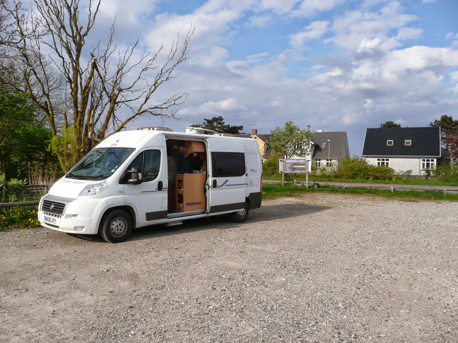
We stayed last night in the port of Hou on this car park. Met and chatted to a couple of locals with a dog.

I can't help wondering what some of the sign boards round here mean?

Plenty of seagulls around.
Today Thursday 1st May we came south and came over the bridge from Jutland to Funen. We are in the town of Middelfart where we were able to fill our LPG tanks - apparently this is one of only two LPG outlets in the whole of Denmark (we use LPG for water heating, central heating, cooking and powering the fridge)

.
We are staying at Middelfart Marina which has lots of boats, mini golf and a load of noisy vanners, from a country which I will leave you to guess, who have just turned up and parked right next to us!
P.S. My apologies to the citizens of the country which I invited you to guess! The noisy vanners proved to be Norwegian - taking advantage of the much cheaper alcoholic beverages available over the water here in Denmark!

On Friday 2nd May we travelled east across the island of Funen, through the main city Odense and on to visit the Ladby Boat. This is a 1000 year old Viking ship which was used as the burial place of a king. He was buried with lavish grave goods including several freshly slaughtered horses and dogs and probably the human sacrifice of one of his servants. The boat was then buried in an earth mound until it was discovered and excavated in the 1930s. The excavated boat is exactly where it was left by the Vikings and is housed within a reconstructed burial mound.

Here is a picture of a model of what the burial might have looked like while it was happening.

Nearby modern day craftspeople are in the process of building an exact replica of the original Ladby Boat. It will hopefully be completed later this year.

We moved on and stayed the night by the sea at a remote spot in north east Funen. I say it was remote - there were lots of people who had travelled there to fish - but they left as it got dark only to return in the morning.

Fishing people near our parking place.

On Saturday 3rd May we crossed the 18 kilometre (11mile) long bridge from the island of Funen to the island of Zealand. Shortly after crossing the bridge we stopped at a motorway service area where we met a couple of vanners from Manaton - the next village to Widecombe - strange coincidence.

We moved on to the Viking Ship Museum at Roskilde which I had visited before in the early 1970s and Ann and I had visited in 2011. I am standing on the Sea Stallion, a reconstruction of one of the Viking Ships in the Museam which in 2007 -2008 sailed from Roskilde, round the north of Scotland to Dublin and back to Roskilde via the English Channel. This was a sea trial to prove that the Vikings could have done these types of voyages in these types of ships.

We then visited Roskilde Cathedral which must vie with the Cathedral at Albi in France as the biggest brick built cathedral in Europe/the World. I must say that after our trip earlier this year I thoughjt that we were done with visiting cathedrals for a while!

The Cathedral is the burial place of many of the kings and queens of Denmark. Here are two of the numerous tombs of the Danish Royalty.

We found this nice spot in a beech wood on the shore of Roskilde Fjord for the night.

Today Sunday 4th May we crossed the Oresund from Denmark to Sweden firstly through this undersea tunnel which in turn led to............

.... .....this enormous bridge! The tunnel and bridge combined are about the same length as the bridge from Funen to Zealand.

On arrival in Sweden we travelled to the nearby Skanor peninsula where we found this amazing carpet of Thrift.

Ann found this worked flint arrowhead? scraper? neolithic in origen?

We are parked for the night at Skanor Harbour between the beach and dunes and a brackish lagoon where we saw these Avocets from our van.

We are by the Baltic Sea now.
It's my brother Robert's 65th birthday today - happy birthday to you - hope you're keeping the water resources of California in good order.

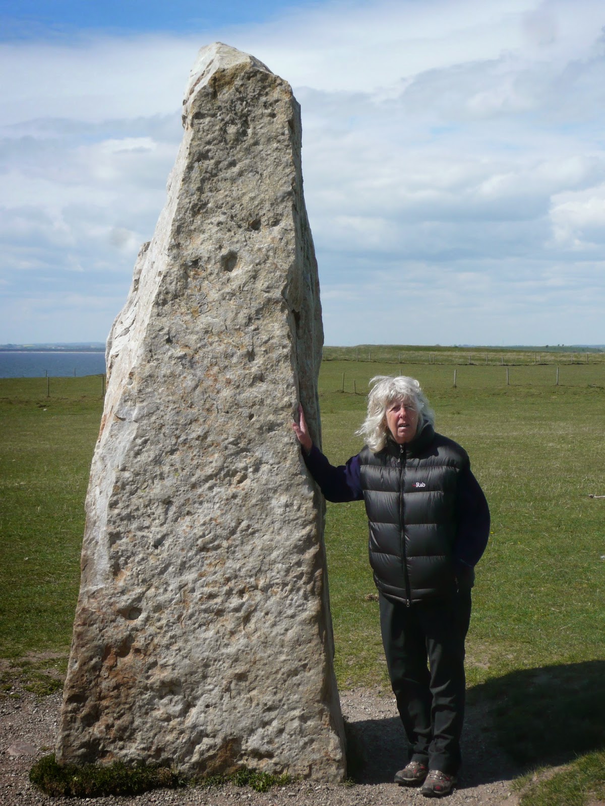
We left Skanor this morning Monday 5th May and travelled east past the city of Ystad to Kaseberga the site of the Ales Stenar boat stone circle.

The stone circle has been messed around with quite a lot in fairly recent times so it is very difficult for today's archaeologists to get a good understanding of when it was constructed and what it was for. The general consensus seems to be that it is not prehistoric but dates from the Viking era about 1000 years ago.
The arrangement of the stones is very similar to that of the Viking cremation sites at Lindholm Hoje in Denmark pictured a few days ago in this blog.
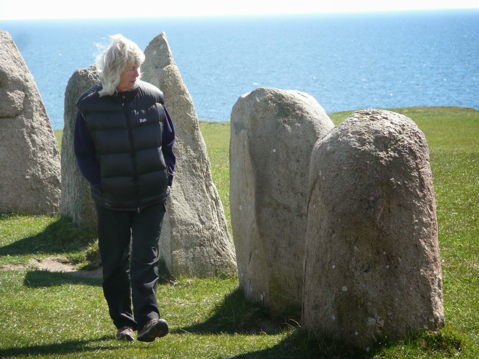
The stone circle is in a commanding position set on a hilltop high above the Baltic Sea with marvellous views in all directions. If indeed it is a Viking cremation or burial site it seems likely to have been for a person of great importance. It is a great pity that the archaeological evidence as to it's origin and purpose has been destroyed.

Kaseberga has a nice fishing harbour with several fish type eateries dotted around. Unfortunately parking is quite expensive there during the day so we are parked about 500 metres inland..........

...........nevertheless we have quite a nice view from where we are parked.
My apologies for being offline for so long - couldn't find any decent wi-fi !

On Tuesday 6th May we visited Sandhammares Nature Reserve which reputedly has the best beach in Sweden. It didn't have many takers that day as it was very cold and windy but certainly a very beautiful place.

We moved on to Stenshuvud Nature Reserve, a very special limestone area by the Baltic with forests and heaths.

There were beautiful spring flowers everywhere. This Pasq flower had an ant visitor.

We would have loved to say overnight in the National Park but there we too may no camping type signs around to make this a possibility.

Our final visit of the day was to Kiviksgraven, an enormous cairn containing a burial chamber.

In the burial chamber was a cist with interesting inscriptions.

I felt that the presentation of the monument was a bit contrived.

The inscriptions were certainly very interesting - what about these otter like creatures?
We stayed the night in a nice car park by the sea in Kivik. The weather became very wet and on Wednesday 7th May we travelled north east to Aryd near Karlshamn were we found a parking place for the night.

On Thursday 8th May we visited the city of Karlskrona as Ann was interested in the Trefaldighetskyrkan domed (church). Unfiortunately it was locked at the time of our visit.

Karlskona seemed a nice enough place but with the church locked we were not inclined to linger there.
We paid a visit to a caravan and campervan dealer up the coast in Kalmar and spent a lot of money on a new waste water release cable for our van - rip off - but what can you do about it?

From Kalmar we crossed the 6 kilometre long bridge to the Baltic island of Oland.

Oland has lots and lots of small disused wooden windmills. Apparently milling was the major industry on the island until the 19th Century.

We travelled down the west coast of the island to its southern extremity and then up the east coast to this small harbour where we stayed for the night.

On Friday 9th May we continued northwards up the east coast of Oland where we saw this runestone.....

.........and a little bit further on this one. Oland is absolutely packed with very up front archaeology.

Further on we saw this memorial to the 15th century vicar Martinus.

It seems that he fell foul of a tax collector.

Oland has more than it's fair share of signs like this. Presumably articulated lorries, buses, caravans and cars are all welcome in this nice empty seaside car park.

We travelled on to the northern end of the island and found a parking place in a forest .a couple of hundred metres from this beach. It's a remote spot.

As you can see it was not very busy. However there was a sign purporting to ban tents, caravans and campervans from the parking area.
On Saturday 10th May as we were leaving we noticed that the officious sign had miraculously vanished!!

Later we visited Trollskogen (Trolls' Forest).

An ancient forest by the sea.

This was as near as we got to seeing a troll.

We had a lively discussion with the nature reserve manager as to why there were so many no campervan signs around.

We returned over the bridge to mainland Sweden and travelled north up the east coast to a rest area where we parked for the night by this river near Oskarshamn. We saw a deer close to where this photo was taken.

On Sunday 11th May it rained. We continued travelling north up the east coast of Sweden. We turned off the main road to a small town by the sea to buy groceries and on the way back to the main road we came upon this moose (they call them elk round here) in a forest.

Later we turned off the main road again following signs to a ruined slot (castle). We didn't find it so decided to park for the night in the car park of this church (St Anna's). As it was Sunday the small congregation turned up for the 6.00 p.m. service which Ann decided to attend!

We could see the ruined castle from the church car park. This morning Monday 12th May we availed ourselves of a tap in the graveyard to fill up our fresh water tank and finally found the castle. It seems to be clearing up a bit.

We travelled north during the day and stopped for the night by a lake a little south of the town of Strangnas, east of Stockholm.

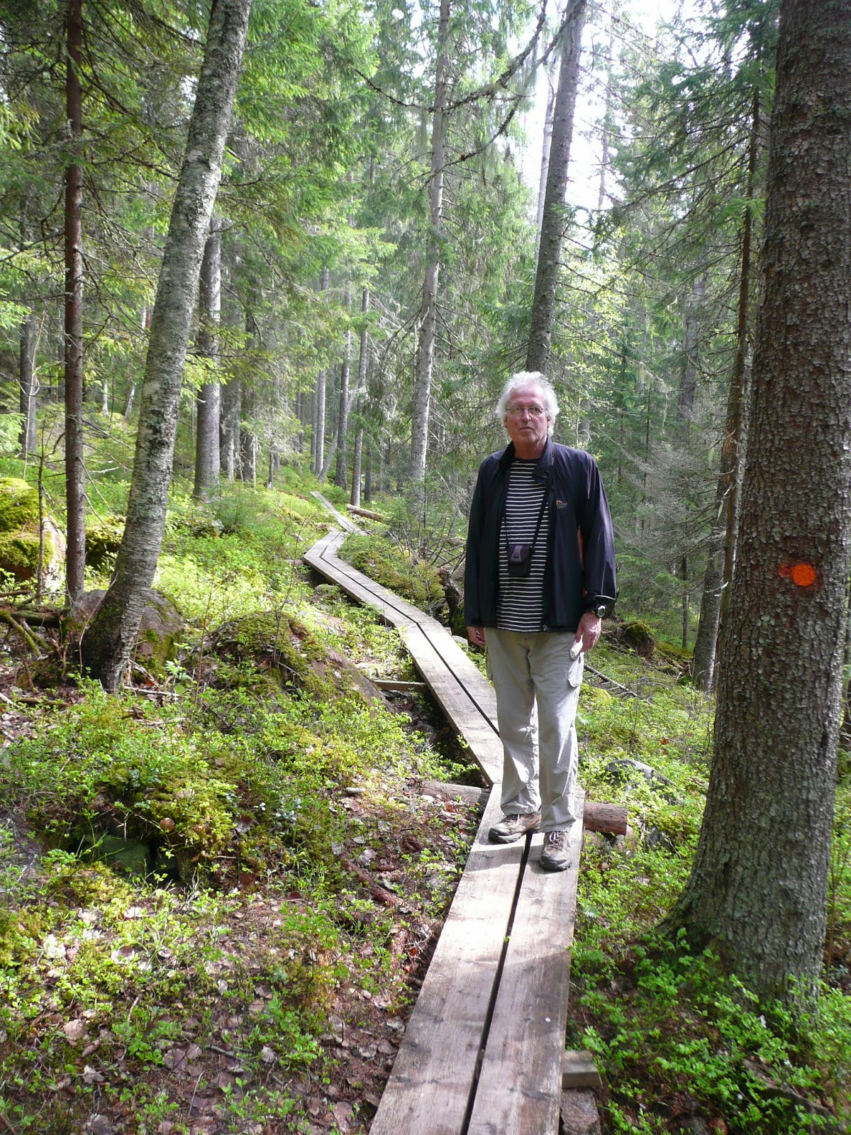
We went for a walk in in the woods around the shore of the lake.

We found trees which had obviously been felled by beavers but unfortunately did not see the creatures themselves.

The ground in the forests round here has masses if huge lichen growth. I think that the deer feed on it in winter - they have to root around under the snow to find it.

On Tuesday 13th May we visited the town of Sigtuna - reputedly the oldest town in Sweden. This is the Town Hall.

Sigtuna is a real tourist trap with lots of quaint old wooden houses, gift shops and eateries.

More interestingly there are many runestones...........

...........and at least three ancient ruined churches.

Later in the day we visited Gamla Uppsala - ancient burial site of the Swedish Royalty. These enormous burial mounds housed cremation burials and date from about 600 AD.

Having bypassed Stockholm we travelled back to the Baltic coast and parked for the night in the small town of Osthammer - you can see our van on the right of the picture. We went out for a meal in a nearby eatery - I had Baltic Herring with mashed potatoes and red berries - a local speciality. Ann had hamburger and chips!

On Wednesday 14th May we briefly visited Gavle - the birthplace of Joe Hill, the great US trade union activist but found it rather difficult with the van so moved on. While looking for a parking place we got lost on small unmade roads in the forest which was quite scary as our sat nav Tomasina (the Tom Tom) kept trying to get us out down impassable little forest tracks.

We eventually found a place to park for the night next to a lake just south of Sonderhamn.
Today Wednesday 15th May we have come north to the town of Hudiksvall where I'm using the Library's excellent wi fi.

Hudiksvall is a nice enough town but we hankered for rurality and moved on.

We went east a few kilometres onto the Hornslandet Peninsula and visited the village of Holick which has a nice beach and on that day a very cold wind.

We had a good look around the Peninsula and saw quite a few cranes feeding on newly tilled fields.

Rather stupidly we ended up not staying there for the night and moving on to a rest area on the main E4 at Harmanger which is a not very interesting little town. It does however have quite an imposing church with separate bell tower - a feature which is common round here.

When we started up our van on Friday 16th May it showed an orange warning light indicating problems with the fuel injection system! The handbook indicated that it was okay to drive with this warning but that a Fiat agent should be consulted as soon as possible. We travelled a few kilometres to the coast at Mellanfjarden and parked in the enormous parking area by the sea which proved to be a campsite! Here's the view out to sea from our parking place.
Her's another view from our van. We spent the day washing our clothes and ourselves and wandering around the village.

Washing scene.

This is the first campsite we have stayed on during this journey. It cost 120 SEK which is about £11 so I suppose by Skandinavian standards that must be cheap - not many things are cheap round here. Can you spot our van?
We still haven't decided what to do about the warning light on the van. There is a Fiat dealer about 200 kilometres north of here.............

On Saturday 17th May we moved on from Mellanfjarden but soon stopped by this raised beach. The land around here has risen by as much as 300 metres since the end of the last ice age 10,000 years ago so you can walk on prehistoric beaches with rounded pebbles high abbove the sea.

We visited a prehistoric burial cairn on a hill nearby.

And below there was a beautiful (present day) beach.

We travelled on for just a few kilometres and found this amazing parking place by the sea at Sorfjarden.

We went for a walk in the adjoining forest - there were numerous large ant hills.

The forest path passed numerous openings to the sea.

We passed a small lake in the forest with a resident pair of Canada Geese.

After tea we went for a walk around "town" there were a few old houses like this but mainly new second homes. There were lots of blown down pine trees, some of which had damaged houses, no shop or school but there was a rather shabby looking chapel.

On Sunday 18th May we moved a few kilometres north to the town of Kvissleby were we knew that one of the few LPG outlets in northern Sweden is located. When we got there we found iut was closed on Sundays so we found a parking place in town by the river and went for a walk along the river. Lots of spring flowers, cyclists, dog walkers and joggers.

On Monday morning 19th May we filled our LPG tanks and travelled north over the beautiful High Coast Bridge.

The High Coast is the area of Sweden where the uplift of the land since the end of the last ice age has been the greatest. We followed the tourist route, marked by road signs with a flower symbol, along small roads and through forests and small villages.

We stopped for the night at the south entrance to the Skuleskogen National Park.
In the morning on Tuesday 20th May we went for a walk in the National Park. There are no roads in the park but numerous well constructed footpaths.

We walked to some wilderness coast. Ann had a paddle in the Gulf of Bothnia which while nominally the sea is so far from the open ocean that the water is so un-salty that you can drink it.We met a Swedish bloke there and afterwards he showed us his nearby house.

His house is by the sea.

As well as a car he has a snowmobile for getting around in the winter.

And a boat for fishing as well as a tractor for clearing the snow from the road to his house.

After saying bye to the Swedish bloke we visited the nearby High Coast Visitor Centre. They had their UNESCO World Heritage Site certificate up on the wall.

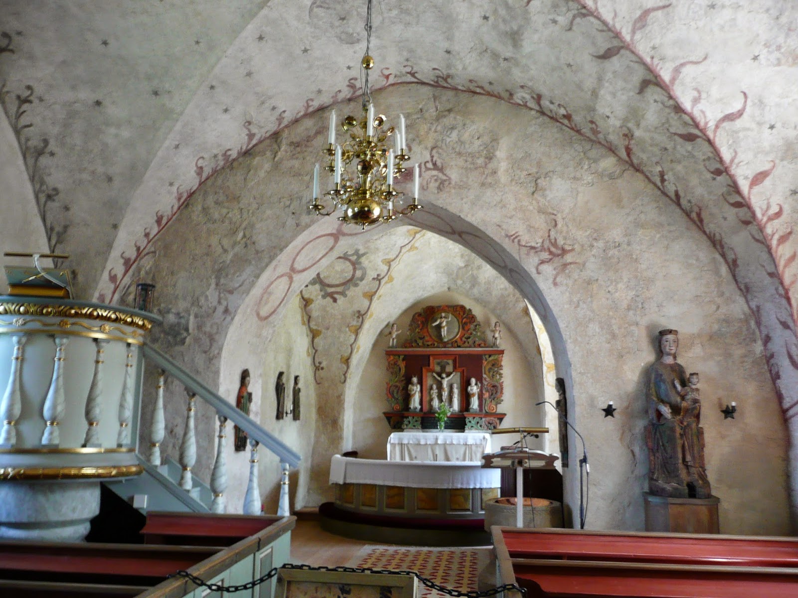
We continued north on the main E4 route stopping off to see a church with a nice wooden bell tower. The church was locked as is usual round here.
We called in at a Fiat Campervan dealer near the city of Ornskoldvik - they reckoned that the orange warning light on our dash was nothing to worry about and to get it checked out after we get home. They did say, rather ominously, that if we got a red light we should stop the vehicle and call our rescue service!

We stayed the night at a rather noisy rest area on the E4 sandwiched between the road and the railway.

Wednesday 21st May brought altogether better things. We continued north to the city of Skelleftea and then on to this really nice piece of waste ground by the sea at Boviken for the night.

There is a beautiful shoreline here and it was really nice and warm despite the fact that it is at 64.8 degrees north, less than 2 degrees from the arctic circle.

There is some nice forest nearby where we found this flower - possibly the flower of the red berries which are commonly served as an accompaniment to fish and meat dishes round here. The forest is however under threat from the development of yet more coastal second homes!
Today Thursday 22nd May we have travelled north and we are in the city of Pitea where we are hoping to find the most northerly LPG outlet in Sweden so that we can top up our tanks before heading into the arctic
We did find the LPG supplier and topped up our tanks - the next place we think we can get some is in Narvik in Arctic Norway.

From Pitea we travelled up the Bothnian coast to Lulea where we visited Gammelstad Kyrkstad - a town of old cottages built around the church. The cottges were for people who had to travel so far to get to church that they had to stay overnight before going home! It is now a UNESCO World Heritage Site. I must say I found it quaint but not that interesting.

The church itself was locked as is usual in these parks - apparently if the churches are left open the copper pipes get stolen! We stayed the night in the Krykstad car park - very quiet.

On Friday 23rd May we left Lulea and travelled north west on minor roads into the interior of northern Sweden. Shortly after leaving our parking place Ann saw a moose but I didn't. However I did see this reindeer - the first on this trip - walking down the road towards us later in the morning.

We found this marvellous parking place where a river flows into a lake at Bodtraskfors and sat around for the rest of the day watching the ducks and terns fishing.

Ann did some sunbathing.

Here's the view from our lounge.

I saw this unfamiliar butterfly - a Wood White perhaps?

As the sun got lower the light was really good - it doesn't get dark at night round here at this time of year.

Today Saturday 24th May we have continued north west and at about mid day crossed the arctic circle at 66.6 degrees north. This is the southernmost latitude at which the sun never sets on the summer solstice.
We are now in the "city" of Jokkmokk a few kilometres north of the arctic circle and have stopped to buy groceries, do blogging and hopefully find a tap to refill our fresh water tank. The sun is out and it's t shirt and shorts weather - not really everyone's' image of the arctic.

There is an interesting looking church in Jokkmokk - apparently it is in Sami (Lapp) style. It is a replica of the original which burned down in the 1980s. There was nothing else to keep us in town so we moved on north.

Later in the day we briefly visited Muddus National Park but as the parking place was uninspiring we moved on after having investigated the local water source.

We stopped for the night on some waste ground by a reservoir nearby.

Shortly after leaving our overnight parking place on Sunday 25th May we encountered this enormous granite gorge. Very difficult to give any idea of the scale in a photograph.

We were travelling through very remote areas with very few houses and very little traffic.

We saw quite a few animals along the way. Here a reindeer.

Here'a a moose - sorry for poor quality of photo. We also saw a fox and some hares. We went through but did not stop in the mining town of Gallivare.

We passed many lakes, many of them still frozen.

We stopped for the night on some waste ground by a river at a "place" called Lappeasuando - about four houses actually - where there were some interesting old boats - reminiscent of viking design?

The next day, Monday 26th May we visited the famous Ice Hotel where Ann's son Jake has stayed on a couple of occasions (in the winter). It's in rather a sorry state at this time of the year!

I'm sure the place must look marvellous when it's open for business but at this time of year it looks a bit like an abandoned whaling station (whatever that looks like?) We stopped briefly in the mining town of Kiruna to buy diesel and groceries.

.We continued north onto higher ground past frozen lakes and snowy hills.

We found an excellent parking place for the night next to a frozen lake. Here's the view from our "sitting room".

The rest area where we stayed the night had a really nice little cottage set aside for communal use - presumably particularly useful for travellers stuck in the snow. We sat up late watching the sun getting lower and lower and eventually going behind a hill. It stayed very light all night but we may need to wait a day or two more before we see the midnight sun.

On the morning of Monday 27th May we continued north west. It had been very cold in the night

We crossed the frontier from Sweden into Norway.

Eventually we came down off the high hills to an atlantic fjord near the city of Narvik. All the trees were just coming into leaf whereas where we had been that morning it was still winter.

We went into Narvik to get Norwegian currency and LPG (LPG is quite rare around these parts hence Ann's heroic pose).

We found a lovely flat car park right on the beach in Narvik Bay where we lazed away the day.

It was really hot and sunny. Ann got her chair out! We saw lots of birds, some porpoises and as the evening drew on we saw an otter on the beach.

Today Wednesday 28th May we have travelled to the Vesteralen Islands.

We crossed this bridge from the Norwegian mainland to the island of Hinnoya. We are now in the town of Sortland on the neighbouring island of Langoya which also has an impressive bridge to it. We are surrounded by snowy mountains and fjords and the sky is cloudless!

After leaving Sortland we went north and found a really nice large car park in a rural location with mountain views for Wednesday night.

On Thursday 29th May we set out again and soon saw the Hurtigrute (coastal boat) going south between the islands of Hinnoya and Langoya. The Hurtigruten (plural) sail between Bergan in the south west and Kirkenes in the far north east of Norway stopping at many locations along the way. There is one boat going each way at each stop every day of the week. The Hurtigruten carry passengers, vehicles and freight. The round trip from Bergan to Kirkenes and back takes two weeks.

Shortly after seeing the Hurtigrute we crossed this impressive bridge form Hinnoya to Andoya.

We travelled north up the east coast of Andoya stoping to look at this interesting octagonal church by the sea. It was locked of course - they are very protective of their copper pipes in these parts.

Eventually we came to the end of the road, the town of Andenes, at the northernmost tip of the Vesteralen Islands. Andenes is a decaying fishing port which has to some extent reinvented itself as a base for whale watching trips. We saw this whale jaw bone by the port.

We found a lovely parking place right next to this gorgeous white sand beach just on the outskirts of Andenes. Unfortunately it turned out to be a campsite but it was such a beautiful place that we reluctantly paid 230 NOK = £23 for the privilege of staying there.

We parked right by the beach with a fantastic view to the north. The weather was bright and sunny and at 69.3 degrees north we were looking forward to seeing the elusive midnight sun.

It was really strange to be on a campsite after so many nights of wild camping. It was however quite a luxury to be connected to mains electricity and to have use of a washing machine and unlimited water for showers etc.

As the evening came the sun moved round from the west into the north and went lower and lower above the horizon. Then just after 24.00, shortly after I took this photo, to our annoyance a cloud moved in from the east and obscured the sun. Astronomical midnight is 01.00 so we missed seeing "it"! The cloud descended to almost sea level after that and we went to bed in disgust.

This morning Friday 30th May we travelled south down the west side of Andoya. It was a bit sad to do this as we had in all probability passed the northernmost point of our journey and we were now heading towards Widecombe.

We stopped along the way for a cup of tea .and saw these two sea eagles from our parking place.
We are now back in Sortland and heading to the south of the island of Langoya where we hope to get a ferry to the Lofoten Islands.

On the way down to the ferry at Melbu we got some good views of the mountains over on the Lofoten Islands but were a bit concerned to see that their tops were sticking out of a thick layer of cloud.

After a shoet crossing we arrived in Fiskabol on the Lofoten Island of Austvagoy. This was taken from the ferry as we approached the quay.

We found a brilliant parking place for the "night" (it doesn't get even slightly dark) nearby with fjord and mountain views and a boardwalk to a high vantage point.

On Saturday 31st May we crossed over to the Island of Vestvagoy and stopped for the day at the village of Stamsund.

We met two Afghan Refugees who were fishing off the quay. They offered me a fish but I unfortunately had to decline as Ann refuses to have such things in the van - what a pity!

Our parking place in Stamsund was right next to the Hurtigruten Dock and I saw both the southbound and northbound ships dock and depart during the evening.

Before leaving Stamsund on Sunday 1st June we saw a couple of locals taking an arctic dip in the sea by our parking place.

We travelled a short way west and stopped for the day on the island of Flakstadoya by this beach.

We saw some Eider Ducks.

We also found what appeared to be the remains of a neolithic cist burial on a grassy mound by the sea. The "grave goods" however are obviously comparatively modern!

We sat up (again) to see the elusive midnight sun but yet again it was hidden behind a cloud.

On Monday 2nd June we travelled to the westward extremity of the Lofoten Islands. There were fantastic views along the way.

The main industry hereabouts is catching and drying cod. There are millions of them hanging on drying racks everywhere.

At the end of the road is the village of A. Reputedly the shortest place name in the world!? We turned round here.

To get to and return from A we had to go through and come back through some fairly horrendous road works.

By the late afternoon we had returned eastwards down the Lofoten chain as far as our parking place on 30th May where we stayed for the night again. This time it was much warmer and sunnier and we spent some time by the fjord sunning ourselves on the rocks.

On Tuesday 3rd June we continued to travel east stopping off at the small island of Husjordoya where we saw the remains of 1000 year old boathouses, a long house and two Sami huts.

On our way back to the Narvik area we ran very low on diesel. There are no filling stations on the E10 between Svolvaer and Kongsvik a distance of 124 kilometres (77 miles). It pays to keep a bit of fuel in hand around these parts. We stopped for the night at the same place where we had stayed on 27th May. This time it was quite crowded with three Norwegian vans, a German van, an abandoned caravan, ourselves and
various local picknickers. It was incredibly hot that afternoon - 30C in the shade!

This morning Wednesday 4th June (our 21st Anniversary) we went into Narvik to restock with LPG. Here's a view of the Narvik iron ore terminal where the ore from Kiruna in Sweden is loaded onto ships.
We are now in the small town of Ballangen on the E6 south of Narvik where we stopped to get groceries and do blogging in the public library.

We continued south on the E6 and stopped for the night on a small island connected to the mainland by two bridges.

We walked down and found these glacially polished granite slabs running down into the sea.

There were coral beaches.

On the far side of the island from where we were parked there was a tide race.

On Thursday 5th June we went south on route 827 to Kjopsvik and took the 50 minute ferry crossing to Drag.

We then rejoined the E6 southwards and stopped at this interesting exposed granite area with stunted pines and small pools.

We stopped for the night at a rest area just off the E6 near Rognan where incidently we had stayed in June 2011 to our round the Baltic trip. We re met some German people Marion and Klaus who we had met a few days ago on our way to the Vesteralen Islands

We went for a walk by the river which was very swollen with snow melt due to the hot weather.

On Friday 6th June we turned left off the E6 towards Sweden and eventually crossed the frontier on high snow covered hills.

We travelled south east into Sweden stopping briefly as we crossed the arctic circle for the obligatory? photo.

We saw plenty of reindeer along the way.

We stopped for the night on a minor road by a bridge over a lake near Racksund.

We lit a fire.

As we are now south of the arctic circle we did not see the midnight sun as it went down behind a hill at about 24.00. This however was what it looked like at 23.00.
Today Saturday 7th June we have travelled south to the town of Vilhelmina where we are parked outside the tourist office right now.

After leaving Vilhelmina we set off along the "Wilderness Way" a 370 kilometre (230 miles) loop into the Swedish wilderness near to the Norwegian border. We stopped for the night by a like just a short way into the route. There was a violent thunderstorm with hail. In the morning it was still raining but there was a glimmer of sunshine and a rainbow.

That morning, Sunday 8th June we stopped at two lots of sensational rapids along the way. This is the Trapstegforsen.

Later in the day we visited the Sami "Church Town" of Fatomomakke. There is a plain wooden church surrounded by Sami huts and "settlers" shacks. It's absolutely in the back of beyond. Apparently this has been an important meeting place for Sami long before they were "Christianised".

We stopped for the night on the high, snowy Stenenjokk plateau

Ann got her chair out and did a bit of sunbathing.

On Monday 9th June we continued along the "Wilderness Way" which was clearly signposted!

We stopped off to view the very imposing 45 metre high Hallingsfallet (waterfall). I say "stopped off", actually it involved about a 50 mile detour on unpaved roads. Distances between places are immense around here.

We found a really nice layby by a lake for the night and saw these Divers diving.

On Tuesday 10th June we compelted the "Wildeness Way" and came south to the City of Ostersund where we parked by the lake.

Ostersund is Sweden's version of Loch Ness and has its own lake monster known as Storsjoodjuret. There are statues of him/her everywhere.

It is a very nice city with airy squares and parks by the lake. Here's the Radhus (town hall) - presumably where you have to go to pay your rates (as present day Council Tax used to be called?).

This is the lake monster's son!?

On Wednesday 11th June we returned to the wilderness close to the Norwegian border passing some old settlements like this deep in the forest.

We crossed a high pass on unsurfaced roads. Here's the marker at the top - 975 metres above sea level - apparently the highest road in Sweden.

We stopped for the night on a high plateau with heath, stunted pines and birches.

On Thursday 12th June we continued south. Saw a Moose with two young. (these are the young).

Moose with young.

Later in the day we visited Falufjallets National Park and walked 2 kilometres to the base of the Njupeskar waterfall (at 93 metres fall apparently the highest in Sweden).

Here are the falls from a bit further away.

After visiting the National Park we crossed the border into Norway and spent the night by this river.

On Friday 13th June we crossed back into Sweden and came a considerable way south to this rest area by a lake at Rada where we stayed overnight.

On Saturday 14th June we reached the city of Karlstad where we parked by a small lake. We walked into the city centre crossing this river on the way.

On Sunday 15th June we went around the east side of Lake Vanern stopping off at Sjotarp to watch boats going through locks on the Gota Canal which connects the the Baltic Sea in the east to the Kattegat neat Goteberg in the west.

We stopped for the night at a rest area near Mariestad and went for a walk in the woods.
Today 16th June we continued south and visited this interesting church.

And this dolmen.
We are now in the town of Svenljunga, Southern Sweden.
Apologies for being offline for so long - couldn't find any wifi that worked!

Svenljunga is quite a nice town - there is this old bridge.......

........and a bit of a water garden..........

..............otherwise it doesn't seem to have too much going for it. We found this parking place for the night behind the theatre with didn't have a production on at the time.

On Tuesday 17th June we travelled SW to the west coast of Sweden and briefly visited the town of Falkenburg where we saw the controversial "wall" sculpture pictured above.

We parked for the night by this beach just south of Falkenburg.

There was a brilliant sunset.

We met a rather strange man who was apparently living in his car at the parking place. We didn't get a photo of him but this is his car. Our conversations didn't amount to much as he spoke no English and we no Swedish.

On Wednesday 18th June we travelled south down the west coast of Sweden stopping off at this beach which had a causeway leading to a granite island.

.
On the causeway.

Later that day we took the short ferry journey from Helsingborg in Sweden to Helsingfor in Denmark. I took this photo of Helsingfor Castle from the ferry (Elsinore Castle from Shakespeare's Hamlet?).

Stopped for the night near Hillerod, Zealand where there is a sign commemorating the planting of this Oak Tree by the King of Denmark in 1940 - the year the country was annexed by the Nazis.

On Thursday 19th June we visited Hillerod Slot (Castle/Chateau). Very big and thronged with far eastern tourists.
We then made a long drive involving crossing to Funen by the 18 kilometre bridge and then on to Jutland.

On Friday 20th June we visited the museum at Silkeborg to see the famous Tollund Man - he was hanged as a human sacrifice in about 400BC and deposited in a bog which preserved his body until it was discovered in modern times.

Later in the day we visited Jelling - burial site of the early Danish Kings. Saw burial mounds, rune stones etc. This rune stone is a painted duplicate which shows the inscriptions better than the original.

We stopped for the night at this very nice heathland area near Billund in Jutland.

On Saturday 21st June we made the short journey to the old town of Ribe in Southern Jutland. Having seen vertually no British registered vehicles for weeks we were surprised to encounter four British vans at the aire. Two from Leeds, one from Hastings and one we didn't talk to.

Ribe is a very interesting old town which we previously visited in 2011.

On Sunday 22nd June we crossed from Denmark to Germany and briefly visited Schloss Gottorf at Scleswig.

There was some interesting art in the grounds but we were too late to visit the museum inside. Ann did however manage to get a sight of their Viking Boat.

We stopped for the night in the Aldi supermarket car park in the village of Aukrug. Very large, very flat, very empty.

On Monday 23rd June we came through the City of Hamburg.

We stopped for the night at Grasberg and on Tuesday 24th June we moved on for an overnight stop at Herzlake - "town" centre pictured above.

On Wednesday 25th June we crossed from Germany into Holland and stayed at Zwartsluis - an atractive little town with waterways and boats all around.

On Thursday 26th June we moved across from Holland to Belgium and stopped at the town of St Job-in-'t-Goor. We found a good place by the canal.

On Friday 27th June we reached Dunkerque and as usual on these occasions we stayed the night in the ferry port car park.

On Saturday 28th June we crossed over to Dover and stayed with Ann's daughter Kerry at her house in Kent. Gareth, Kerry's partner has some sheep which I think will soon be in his freezer.
On Sunday 29th June we moved on to Bristol and stayed at Ann's other daughter Hannah and her partner George's house.
Many thanks to Kerry, Gareth, Hannah and George for your excellent hospitality.
On Monday 30th June we returned home to Widecombe.
Our journey lasted 70 days and we travelled 6792 miles (10935 kilometres) excluding ferry crossings.
Bye for now, Roger.